

GeoLocationTagger app for iPhone and iPad
Developer: Andreas Pantle
First release : 09 Nov 2015
App size: 1.58 Mb
I like to take photos with some cameras that arent equipped with a GPS receiver. Its great to view where I had taken these photos. This is only possible if the location information is stored in the metadata of the pictures.
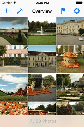
Setting the location of each pictures takes a lot of time even if it is possible mobile. With GeoLocationTagger you need only a few steps for storing location informations in metadata of up to 50 photos:
1. Take a waypoint
2. Add photos to the overview
3. Assign the waypoint to the photos
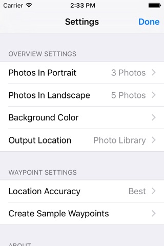
This app lets you change or add an Exif tag (V2.3.0.0) with the location information and export it to the photo library or the app document folder for accessing with your computer.
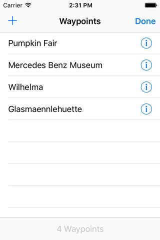
-> Waypoints
* Add waypoints manual (just enter the location data)
* Add waypoints from actual location (internal A-GPS)
* Add waypoints from existing photos (maybe you have taken a photo with a build in camera)
* Specify a name for fast find
* Support for Latitude, Longitude, Altitude, Speed (km/h,mph and knots), Direction (true and magnetic)
* Showing you the waypoint at the internal map
-> Photos
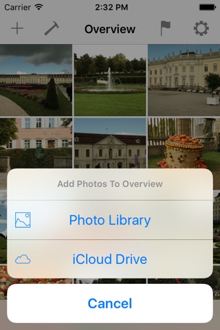
* Add photos from the internal library
* Add photos (jpg) from iCloud drive
* You have an overview with all the photos that will be used for the next waypoint assignment
Please note that you can handle up to 50 photos at the moment in one assignment step.